Maps Teaching Resources
Bring printable maps of Australia and countries around the world, map worksheets and activities and a whole lot more into your HASS lesson planning! This teaching resource collection was created by the primary teachers at Teach Starter to help you familiarise your students with different countries and their positions within the world.
This teaching resource collection includes both blank and labelled maps of various countries in the southern and northern hemispheres, so you can make the edits you need to fit your lesson planning needs.
New to teaching maps? Read on for a primer from our teacher team including a kid-friendly definition of maps, plus a look at what students should know about this tool before they leave primary school.
What Are Maps? A Kid-Friendly Definition
Trying to explain maps to your students? Here's a simple definition for kids:
A map is like a picture of a place, like your room, your school, or your city. It helps you understand where things are and how to get to them.
Maps are made up of special symbols and colours to help you find a variety of different things, like roads, rivers, mountains, and buildings. By using a map, you can find your way to a new place and explore the world around you!
What Are the Different Types of Maps?
Throughout primary school, students will encounter a variety of maps. Some are more general (like a map showing state boundaries), while others contain more detailed images that pinpoint right where their school sits in a neighbourhood! Each map type serves its own purpose and can teach our students more about their community and our world.
Here's a look at some of the various types of maps you might share with your students:
- Political map — No, this isn't about politics! A political map shows us the boundaries and locations of countries, states, and cities, as well as other man-made features such as roads.
- Physical map —We use physical maps to see the physical features of an area, such as mountains, rivers, and lakes.
- Topographic map — Based on the concept of 'topography,' this type of map the elevation and contours of an area and is often used for hiking or other outdoor activities.
- Climate map — Just as the name implies, this kind of map shows the different types of climate in a region, such as temperature and precipitation patterns.
- Road map — We don't see paper versions of these much anymore, but a road map shows the network of roads in an area and is typically used for driving directions.
- Geological map — A geological map shows the types of rocks and minerals found in an area, as well as fault lines and other geological features.
- Nautical map— Taking to the water? A nautical map will come in handy! It shows the features of bodies of water, such as depth, currents, and underwater hazards.
- Thematic map — A thematic map shows a specific theme or topic, such as population density, natural resources or political affiliations.
What Should Kids Know About Maps?
By the time they leave primary school, students should have a solid understanding of maps and how to use them to explore the broader world! Here are some of those map basics they should know:
- What's the purpose of a map? Kids should know that maps offer a visual representations of the world, which help us to locate places, find directions, and understand the relationship between different areas.
- The basic features — From a compass rose to a map key, kids need to be able to identify the features of a map and know how to use them.
- Reading and interpreting maps — Whether it's a road map, topographical map or weather maps, kids should know how to read it and how to interpret it.
- Cardinal directions — Kids should know the difference between north, south, east and west and how to use the four cardinal directions to navigate a map.
- Locating places — Kids need to learn to use coordinates — such as latitude and longitude — and how to locate places using them, as well as pinpointing location with the use of landmarks, street names, and other features.
- Plus Plan
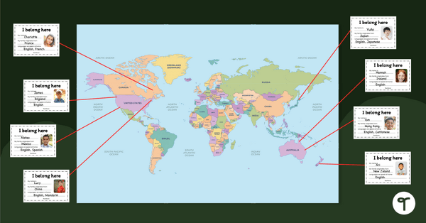
Our Belonging Map Classroom Display
Investigate your students’ heritage with this belonging map to display in the classroom.
- Free Plan
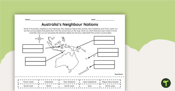
Countries Neighbouring Australia - Cut and Paste Worksheet
Discover the location of some of the countries neighbouring Australia with this simple cut-and-paste worksheet.
- Plus Plan
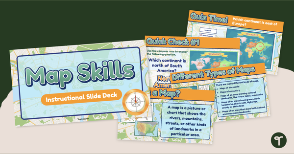
Map Skills Teaching Presentation
Teach basic map skills to younger students with this visually appealing and age-appropriate teaching presentation.
- Plus Plan
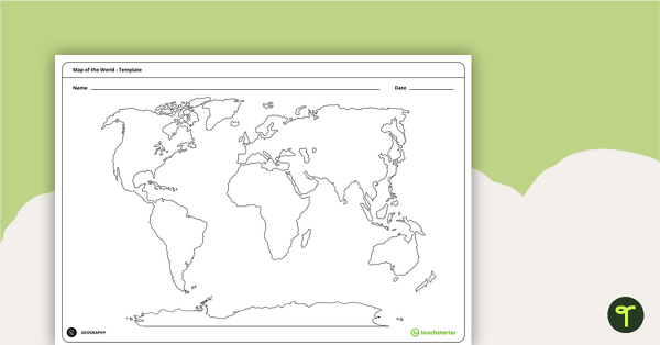
Blank Map of the World - Template
Teach your students about the world’s seven continents and five oceans with this blank map of the world for labelling.
- Free Plan
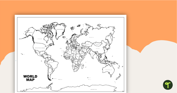
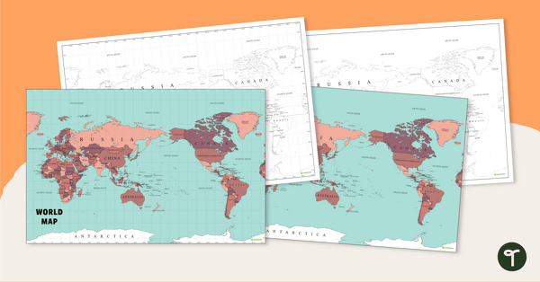
World Map with Countries - Black and White
Teach your students about the continents and countries of the world with this black-and-white world map.
- Plus Plan
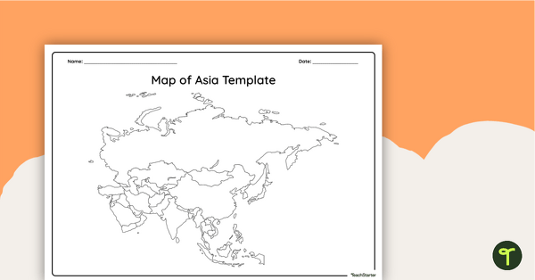
Blank Map of Asia - Template
Record and represent data about the location of significant places with this printable blank map of the continent of Asia.
- Plus Plan
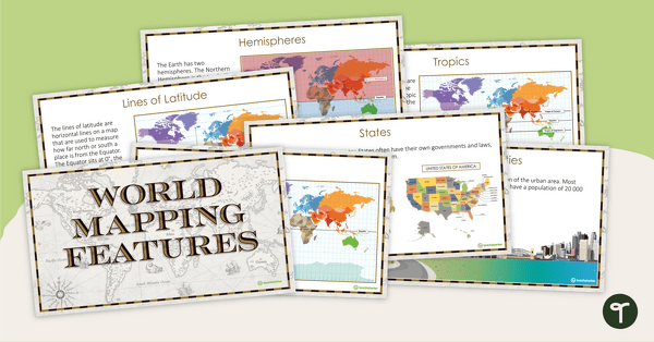
World Mapping Features – Teaching Presentation
Explore the key map features of world maps with this 18-slide PowerPoint presentation.
- Plus Plan
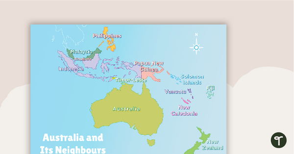
Australia and Its Neighbours - Poster and Labelling Activity
A set of maps and worksheet for students to use when looking at Australia and its neighbours.
- Plus Plan
Australia-Centred World Map
Teach your students about the continents, oceans and countries of the world with this Australia-centred world map.
- Plus Plan
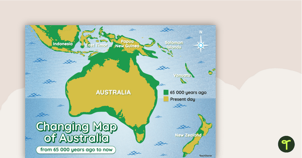
Changing Map of Australia - 65 000 Years Ago to Present Day
A map showing the changes in Australia's coastline from 65 000 years ago to the present day.
- Plus Plan
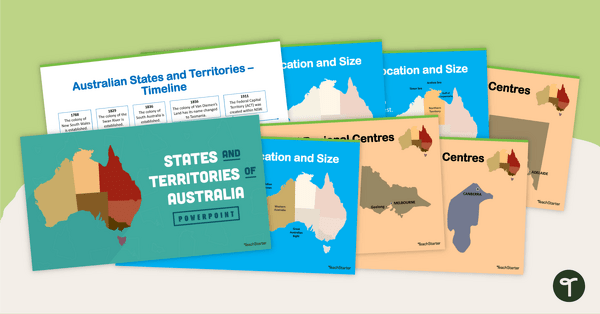
States and Territories of Australia PowerPoint
Explore Australia's six states and two territories with this 27-slide editable teaching presentation.
- Free Plan
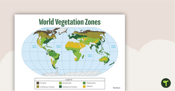
Map of the World's Vegetation Zones
Locate and explore the different biomes of the world with this engaging classroom poster.
- Plus Plan
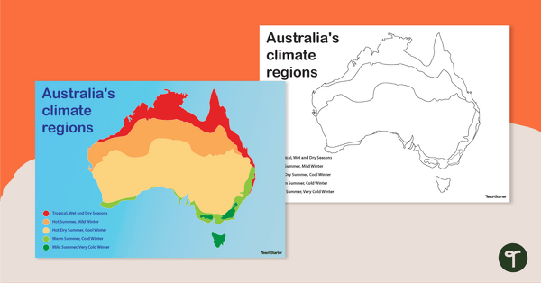
Australian Climate Regions Poster and Worksheet
A poster and a worksheet outlining the climate regions in Australia.
- Plus Plan
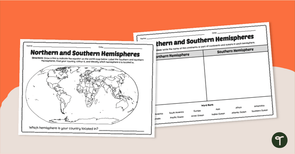
Earth's Hemispheres Worksheets
Practise identifying landforms in the northern and southern hemispheres with a pair of printable geography worksheets.
- Plus Plan
Australian States, Territories and Capital Cities - Class Display
Brighten up your classroom bulletin boards with a vibrant and informative classroom display about Australia’s states and territories.
- Plus Plan
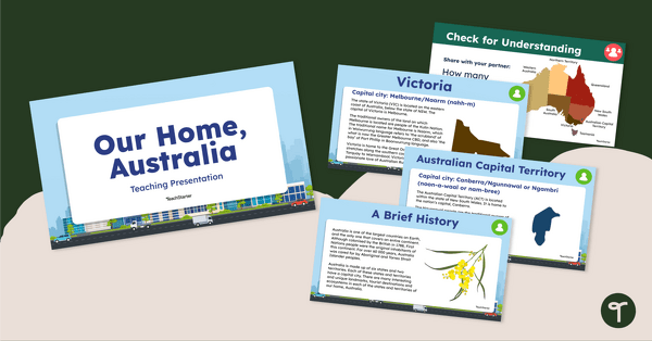
Our Home, Australia: Teaching Presentation
Familiarise your students with the six states and two territories of Australia with this informative teaching presentation.
- Plus Plan
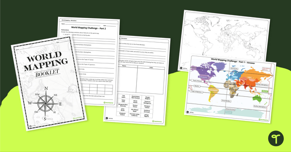
World Mapping Workbook
Develop mapping skills by plotting key features and locations onto a map of the world.
- Plus Plan
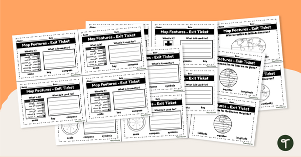
Features of Maps - Exit Tickets
Assess student map and globe skills with twenty exit ticket worksheets.
- Plus Plan
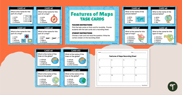
Feature of Maps - Task Cards
Explore the features of maps and globes with a set of multiple-choice task cards.
- Free Plan
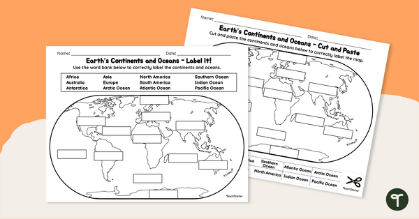
Labelling the Continents and Oceans Worksheets
Turn Geography into a fun and educational learning experience with our cut-and-paste worksheets!
- Free Plan
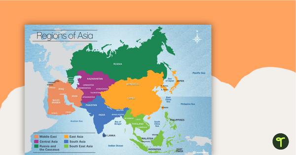
Map of the Regions of Asia
A map showing the layout, regions and major countries of Asia.
- Plus Plan
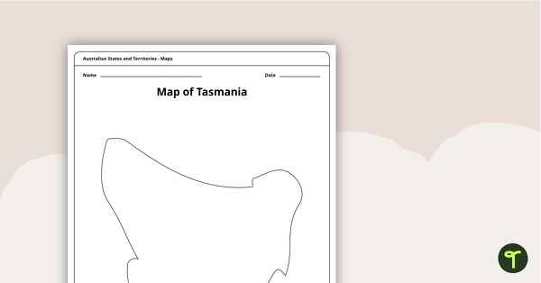
Blank Map of Tasmania Template
Record and represent data about the location of significant places with this printable blank map of the Australian state of Tasmania.
- Free Plan
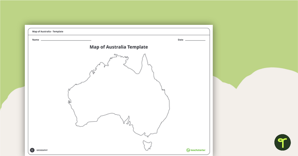
Blank Map of Australia - Template
Record and represent data about the location of significant places with this printable blank map of the continent of Australia.
- Plus Plan
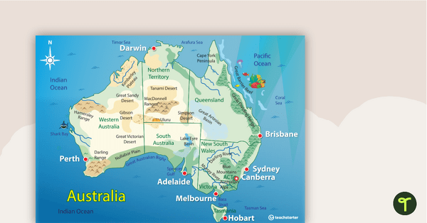
Australian Landform Map
A map of Australia showing the major landforms.
- Plus Plan
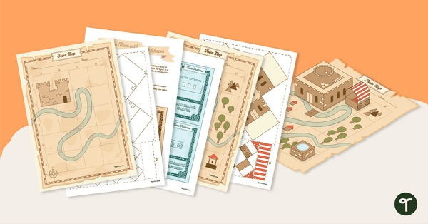
Ye Olde Geometry Town Project
Build a charming medieval village in our Ye Olde Geometry Town project, designed to give your students engaging hands-on practice with multiple geometry standards.
- Free Plan
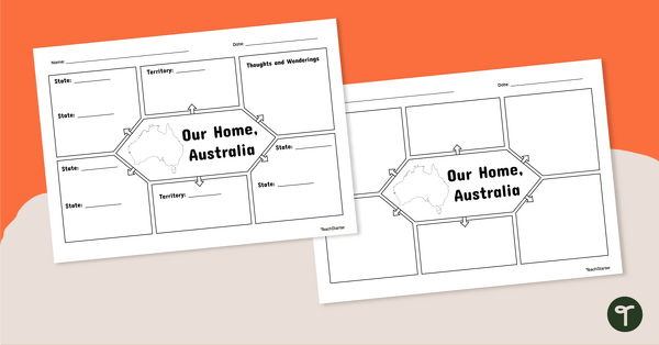
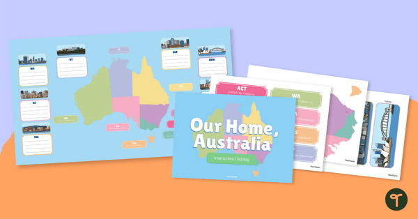
Our Home, Australia: Note-Taking Graphic Organiser
Summarise key information about Australia’s states and territories with this note-taking graphic organiser.
- Plus Plan
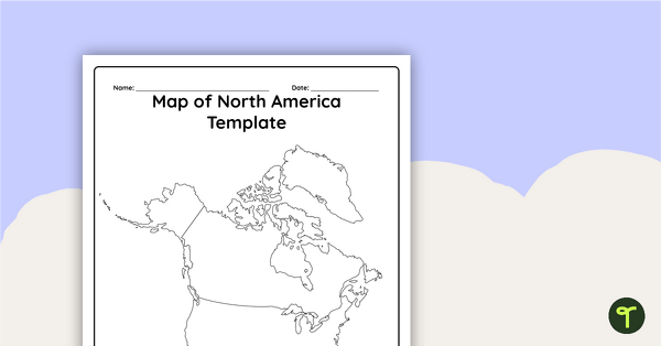
Blank Map of North America - Template
Record and represent data about the location of significant places with this printable blank map of the continent of North America.
- Plus Plan
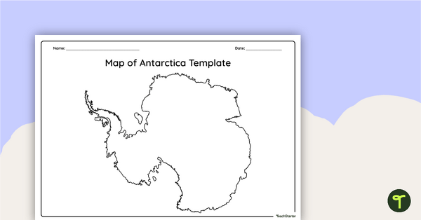
Blank Map of Antarctica - Template
Record and represent data about the location of significant places with this printable blank map of the continent of Antarctica.
- Plus Plan
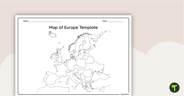
Blank Map of Europe — Template
Record and represent data about the location of significant places with this printable blank map of the continent of Europe.
- Plus Plan
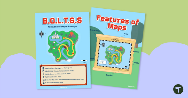
B.O.L.T.S.S Features of Maps Posters for the Classroom
Teach the BOLTSS mnemonic and explore the features of maps using this set of colourful classroom posters.
- Plus Plan
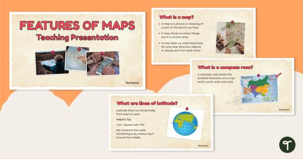
Features of Maps - Teaching Presentation
Explore the most common features of maps with this engaging teaching presentation.
- Plus Plan
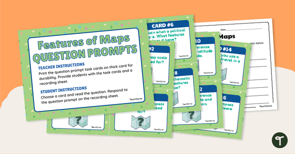
Features of Maps - Question Prompt Task Cards
Assess your students' understanding of the features of maps with this set of 16 question prompt task cards.