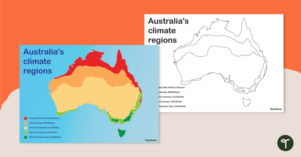
A poster and a worksheet outlining the climate regions in Australia.
A Handy Climate Map of Australia
When studying the characteristics of a continent, one feature that is often explored is climate. Climate can be loosely defined as the weather conditions prevailing in an area in general or over a long period. Sometimes, very large areas of land experience the same general climate. Other times, there can be many different climates within a very small area of land!
Use this poster and worksheet when teaching your students about Australia and its various climate regions. On the poster, Australia’s climate is classified according to the following five climate zones:
- tropical (wet and dry seasons)
- hot summer, mild winter
- hot dry summer, cool winter
- warm summer, cold winter
- mild summer, very cold winter.
Multiple Uses for This Climate Zones of Australia Poster and Worksheet
This classroom poster and accompanying worksheet make a great addition to your Geography lessons and can be used in a multitude of ways in your classroom. Here are some suggestions:
Explore the climate zones of Australia as a whole-class activity
Project the colour poster onto your interactive whiteboard for a paperless lesson or class review session. Use the poster as a stimulus for a conversation about the types of biomes that might be found within each climate region on the map. Students could also suggest the types of flora and fauna that might be found within each region.
Practise mapping skills independently
Provide students with their own printed copy of the Australian climate zones map. Have the students use their own colour-coding system to colour in each of the climate zones, then record the colours used in the legend in the bottom corner of the map.
Download Your Climate Zone Map of Australia
Use the Download button above to access the easy-print PDF version of this resource.




This looks like a fantastic resource that I'm going to use tomorrow - thanks