Practise identifying the symbols found on a map with a map symbol matching activity.
What Are Map Symbols?
What do all those symbols on maps stand for? Symbols are small pictures that stand for different features on a map. A symbol is often drawn to look like what it represents. For example, a triangular shape is often used to denote a mountain. A desert is often shown by a group of dots that might look a little bit like sand. A forest could have little shapes that look like trees. A railroad can be shown as a line with bars drawn across it, like a train’s track. These are simple ideas for you and me, but they might be confusing for your young map enthusiasts. We’re here to help!
How to Use This Map Symbols Activity
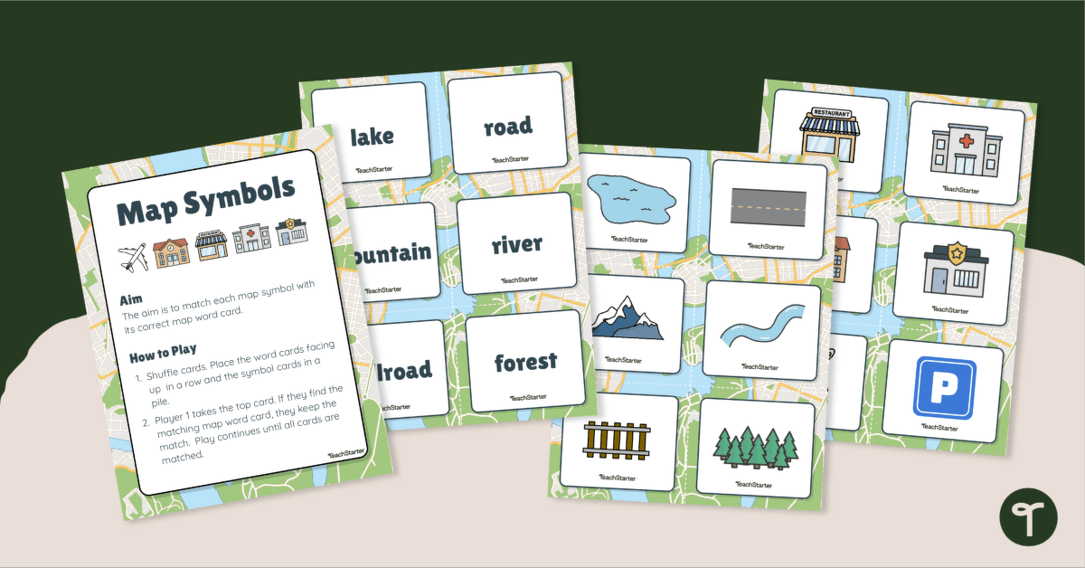
Enhance your Geography lessons with our map symbols matching activity. This resource serves as an excellent introduction or review of the different types of symbols and features found on a map. It provides a series of word cards with accompanying image cards to match.
Students shuffle the cards, then place the word cards facing up in a row and the symbol cards in a pile.
Player 1 takes the top card. If they find the matching map word card, they keep the match. Play continues until all cards are matched.
The map symbols included in this resource are: lake, dining, road, hospital, mountain, school, river, police station, railroad, forest, dining, hospital, airport, parking.
Before You Download
Use the dropdown arrow on the Download button to select between the quick-print PDF or the editable Google Slides version of this resource.
Get more handy map skills resources here!
This resource was created by Lindsey Phillips, a Teach Starter collaborator.


0 Comments
Write a review to help other teachers and parents like yourself. If you'd like to request a change to this resource, or report an error, select the corresponding tab above.