Geography Posters for Teachers
- Plus Plan
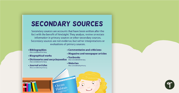
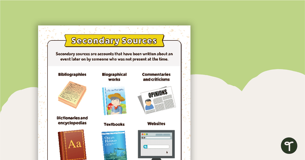
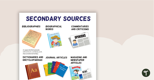
Secondary Sources Poster
A poster providing the definition and some examples of secondary sources.
- Plus Plan
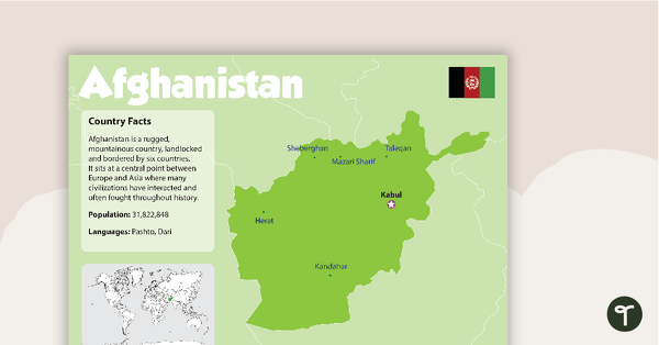
Afghanistan Country Profile Poster
A poster about Afghanistan – suitable for your Geography or LOTE classroom.
- Plus Plan
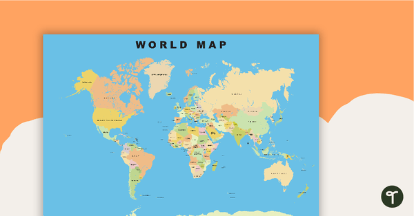
World Map
Show your students the map of the world with countries and bodies of water.
- Plus Plan
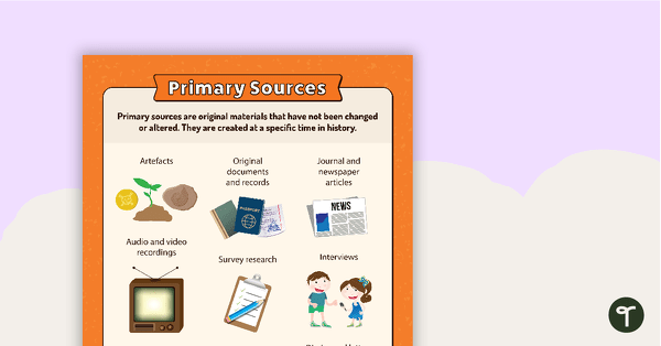
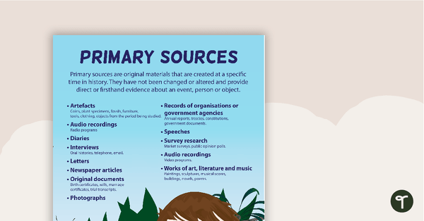
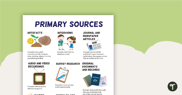
Primary Sources Poster (Alternate Version)
A poster providing the definition and some examples of primary sources.
- Plus Plan
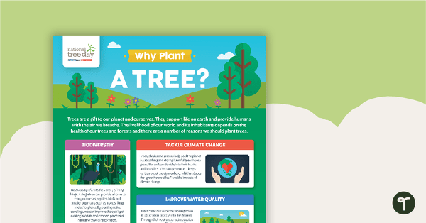
National Tree Day – Why Plant a Tree? Infographic
An infographic poster about the importance of trees in celebration of National Tree Day.
- Plus Plan
Primary Sources Poster
A poster providing the definition and some examples of primary sources.
- Plus Plan
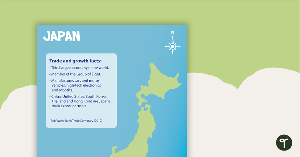
Japan Profile Poster Pack
A pack of 5 posters about Japan – suitable for your Geography or LOTE classroom.
- Plus Plan
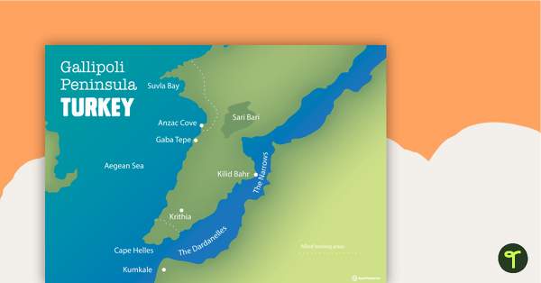
World War One Maps
A set of maps to use in the classroom when learning about WW1.
- Plus Plan
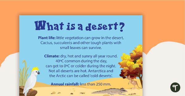
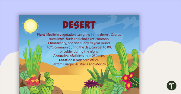
What is a Desert? Poster
A poster with information about the plant life, climate and annual rainfall that characterise a desert environment.
- Plus Plan
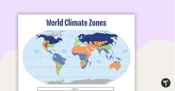
Map of the World's Climate Zones
A poster to display in the classroom when locating the different climates of the world.
- Plus Plan
Secondary Sources Poster (Alternate Version)
A poster providing the definition and some examples of secondary sources.
- Plus Plan
Terrestrial Ecosystem Posters
Six educational posters describing types of Terrestrial Ecosystems.
- Plus Plan
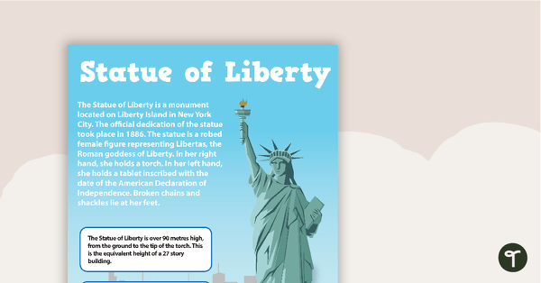
Seven US Landmarks Posters
A set of 7 posters highlighting some of the United States most famous Landmarks.
- Plus Plan
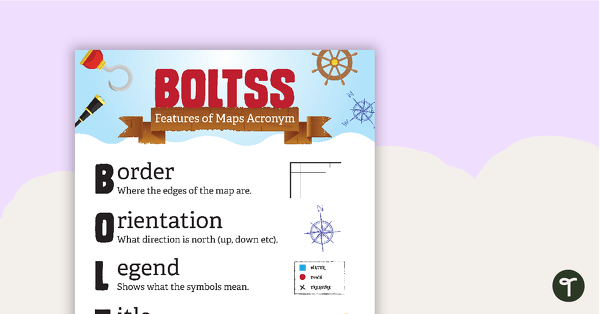
Features of Maps Posters
A set of 2 posters outlining the features of a map.
- Plus Plan
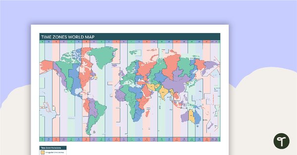
Time Zones World Map
A poster to display in the classroom when locating the different time zones of the world.
- Plus Plan
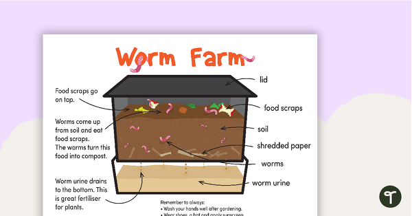
Worm Farm Poster Pack
A set of 7 posters explaining the process of creating a worm farm and how a worm farm works.
- Plus Plan
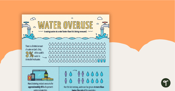
Water Overuse Infographic Poster
An infographic displaying important facts and statistics about water overuse.
- Plus Plan
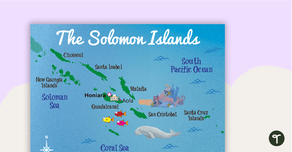
Map of The Solomon Islands
A map showing the layout and major cities in The Solomon Islands.
- Plus Plan
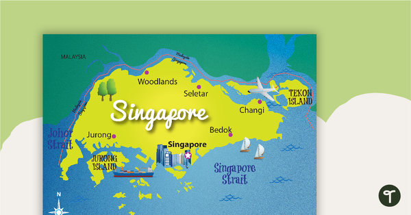
Map of Singapore
A map showing the layout and major cities in Singapore.
- Plus Plan
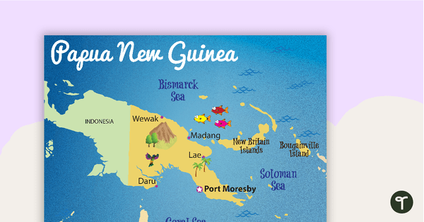
Map of Papua New Guinea
A map showing the layout and major cities in Papua New Guinea.
- Plus Plan
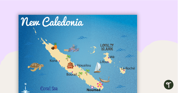
Map of New Caledonia
A map showing the layout and major cities in New Caledonia.
- Plus Plan
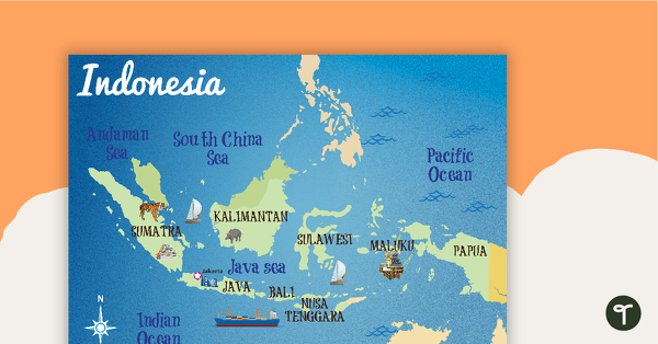
Map of Indonesia
A map showing the layout and major cities in Indonesia.
- Plus Plan
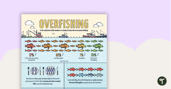
Overfishing Infographic Poster
An infographic displaying important facts and statistics about overfishing.
- Plus Plan
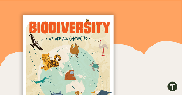
Biodiversity Poster
A poster to help your students explore the topic of biodiversity.
- Plus Plan
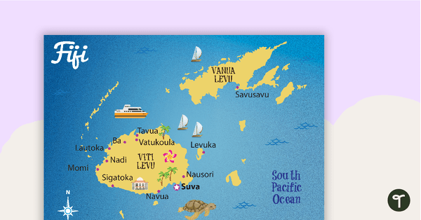
Map of Fiji
A map showing the layout and major cities in Fiji.
- Plus Plan
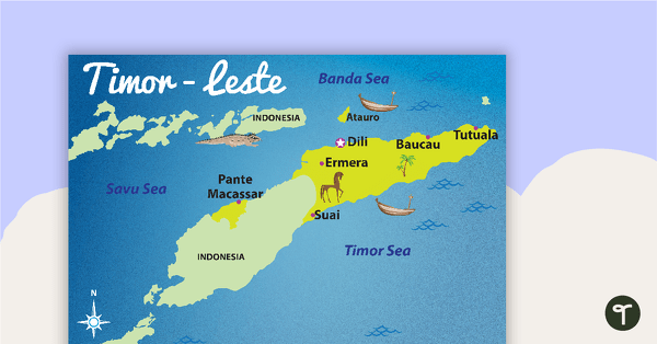
Map of Timor-Leste
A map showing the layout and major cities in Timor-Leste.
- Plus Plan
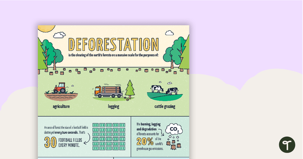
Deforestation Infographic Poster
An infographic displaying important facts and statistics about deforestation.
- Plus Plan
Tertiary Sources Poster (Version 2)
A poster highlighting some examples of tertiary sources.
- Plus Plan
Secondary Sources Poster (Version 2)
A poster highlighting some examples of secondary sources.
- Plus Plan
Primary Sources Poster (Version 2)
A poster highlighting some examples of primary sources.
- Plus Plan
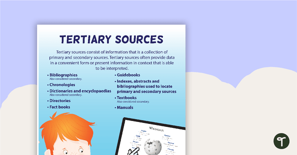
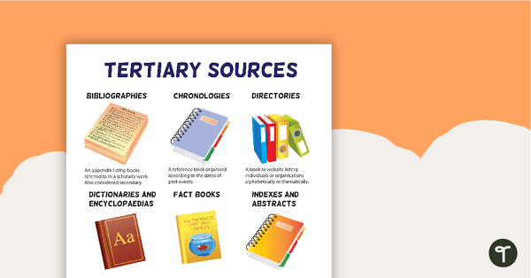
Tertiary Sources Poster
A poster providing the definition and some examples of tertiary sources.
- Plus Plan
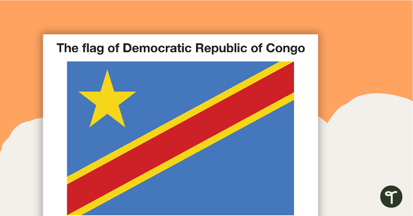
African Flags - Colour
Eight coloured flags from Africa.