Geography
Pupils should extend their knowledge and understanding beyond the local area to include the United Kingdom and Europe, North and South America. This will include the location and characteristics of a range of the world’s most significant human and physical features. They should develop their use of geographical knowledge, understanding and skills to enhance their locational and place knowledge.
- Plus Plan
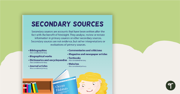
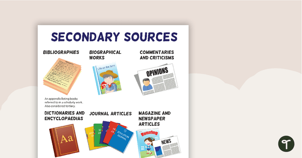
Secondary Sources Poster
A poster providing the definition and some examples of secondary sources.
- Plus Plan
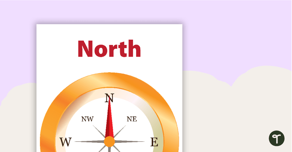
Compass Direction Posters - Individual
Posters displaying the primary compass directions.
- Plus Plan
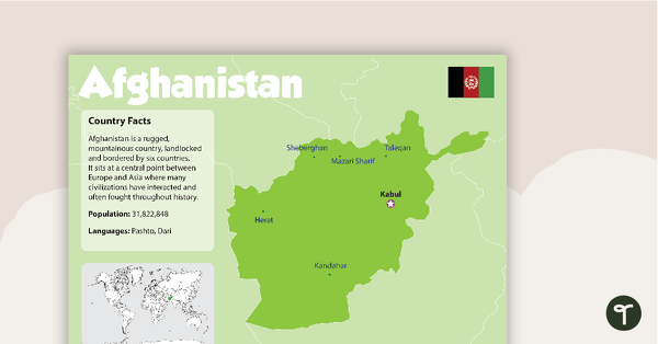
Afghanistan Country Profile Poster
A poster about Afghanistan – suitable for your Geography or LOTE classroom.
- Plus Plan
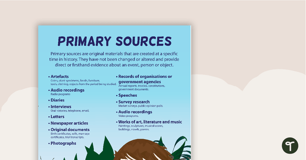
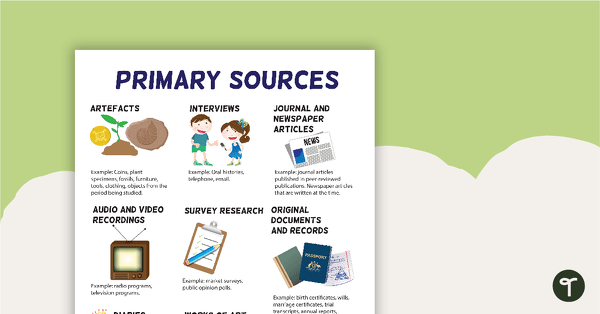
Primary Sources Poster
A poster providing the definition and some examples of primary sources.
- Plus Plan
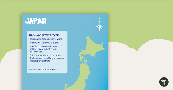
Japan Profile Poster Pack
A pack of 5 posters about Japan – suitable for your Geography or LOTE classroom.
- Plus Plan
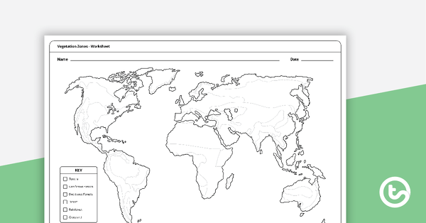
Vegetation Zones Mapping Template
A 1 page worksheet for students to use when learning about different vegetation zones around the world.
- Plus Plan
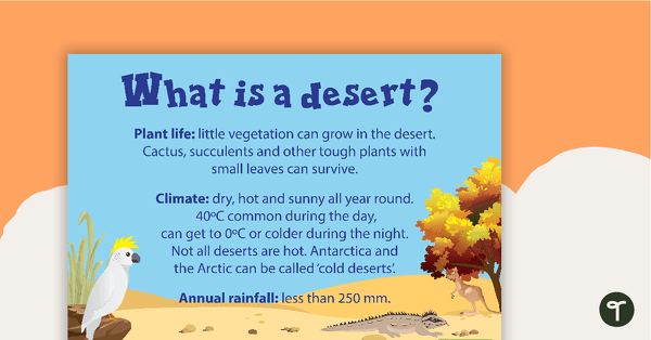
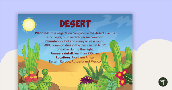
What is a Desert? Poster
A poster with information about the plant life, climate and annual rainfall that characterise a desert environment.
- Plus Plan
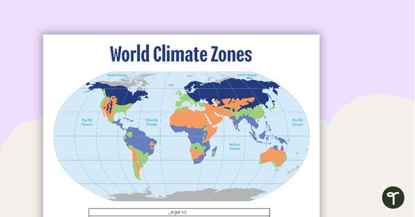
Map of the World's Climate Zones
A poster to display in the classroom when locating the different climates of the world.
- Plus Plan
Terrestrial Ecosystem Posters
Six educational posters describing types of Terrestrial Ecosystems.
- Plus Plan
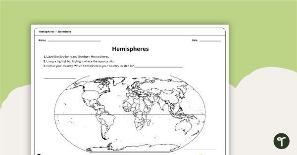
Hemispheres Worksheet
A worksheet highlighting the hemisphere, equator and country locations.
- Plus Plan
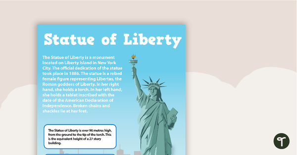
Seven US Landmarks Posters
A set of 7 posters highlighting some of the United States most famous Landmarks.
- Plus Plan
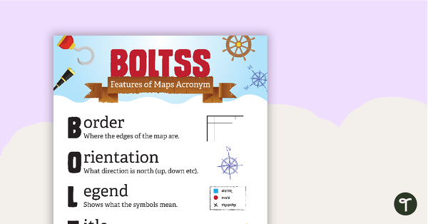
Features of Maps Posters
A set of 2 posters outlining the features of a map.
- Plus Plan
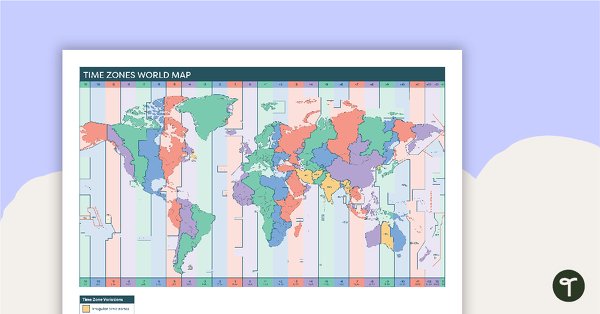
Time Zones World Map
A poster to display in the classroom when locating the different time zones of the world.
- Plus Plan
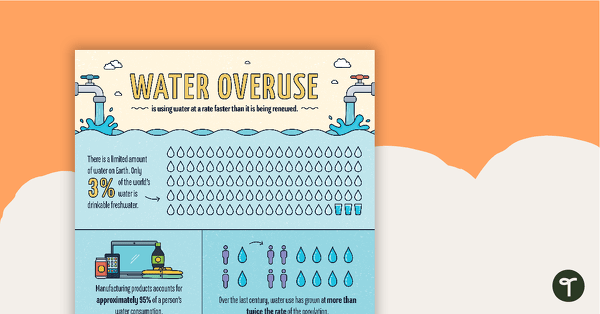
Water Overuse Infographic Poster
An infographic displaying important facts and statistics about water overuse.
- Plus Plan
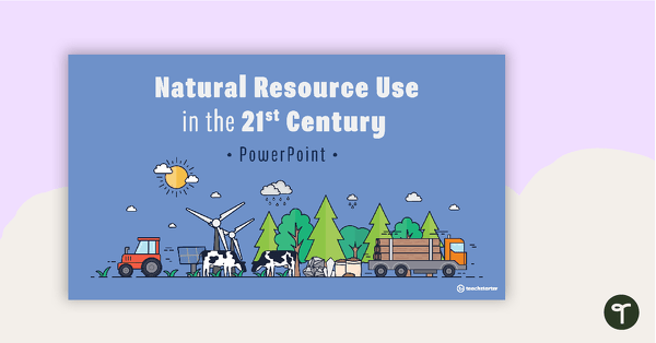
Natural Resource Use in the 21st Century PowerPoint
A 22 slide editable PowerPoint template to use when exploring how natural resources are used by humans in the 21st century.
- Plus Plan
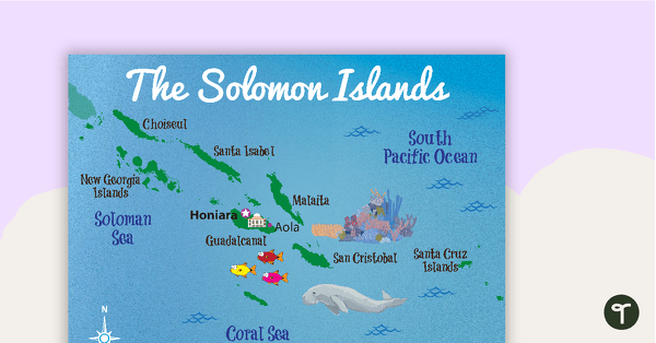
Map of The Solomon Islands
A map showing the layout and major cities in The Solomon Islands.
- Plus Plan
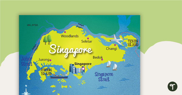
Map of Singapore
A map showing the layout and major cities in Singapore.
- Plus Plan
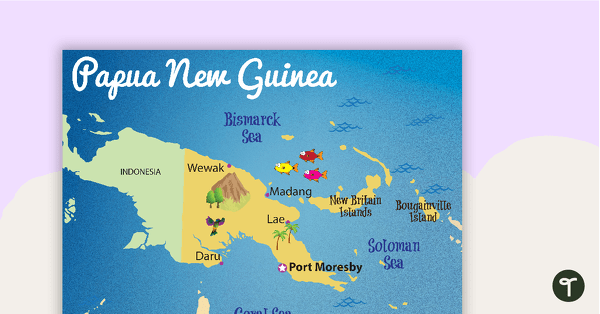
Map of Papua New Guinea
A map showing the layout and major cities in Papua New Guinea.
- Plus Plan
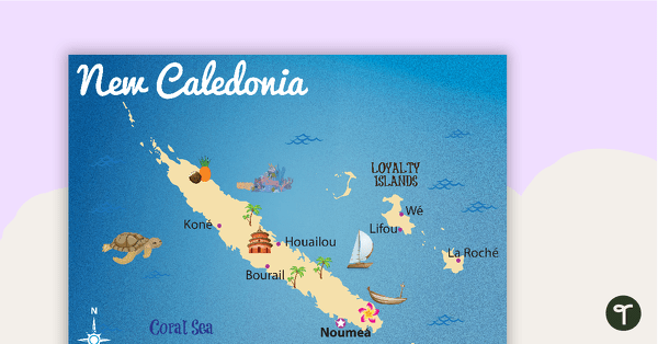
Map of New Caledonia
A map showing the layout and major cities in New Caledonia.
- Plus Plan
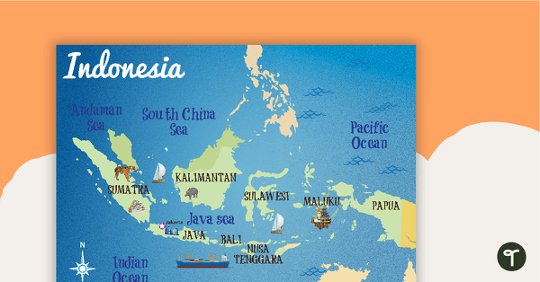
Map of Indonesia
A map showing the layout and major cities in Indonesia.
- Plus Plan
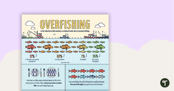
Overfishing Infographic Poster
An infographic displaying important facts and statistics about overfishing.
- Plus Plan
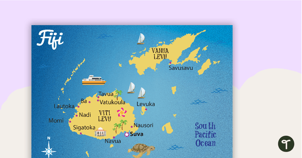
Map of Fiji
A map showing the layout and major cities in Fiji.
- Plus Plan
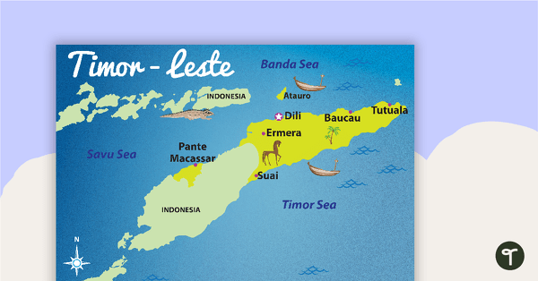
Map of Timor-Leste
A map showing the layout and major cities in Timor-Leste.
- Plus Plan
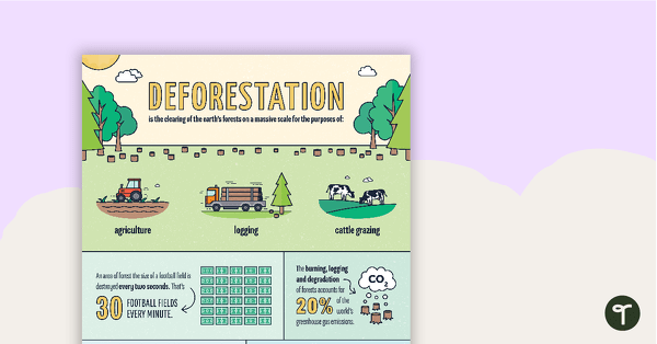
Deforestation Infographic Poster
An infographic displaying important facts and statistics about deforestation.
- Plus Plan
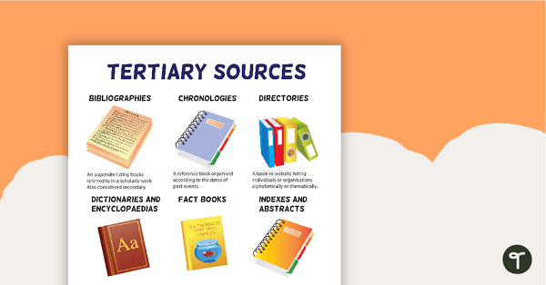
Tertiary Sources Poster (Version 2)
A poster highlighting some examples of tertiary sources.
- Plus Plan
Secondary Sources Poster (Version 2)
A poster highlighting some examples of secondary sources.
- Plus Plan
Primary Sources Poster (Version 2)
A poster highlighting some examples of primary sources.
- Plus Plan
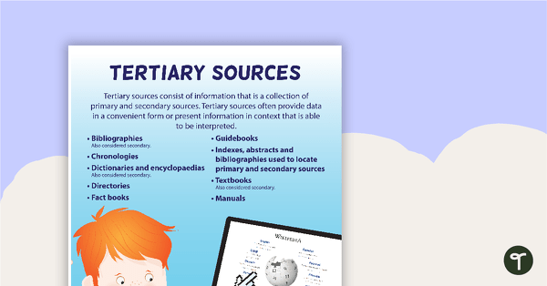
Tertiary Sources Poster
A poster providing the definition and some examples of tertiary sources.
- Plus Plan
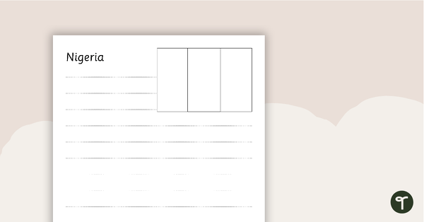
African Flags Worksheets - BW
Eight black and white worksheets with flags from Africa.
- Plus Plan
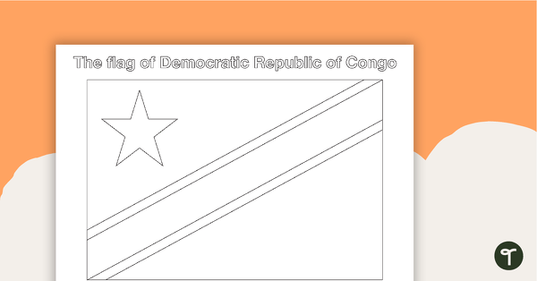
African Flags - BW
Eight black and white flags from Africa.
- Plus Plan
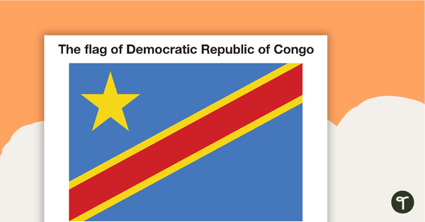
African Flags - Colour
Eight coloured flags from Africa.
- Plus Plan
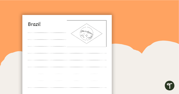
South American Flags Worksheets - BW
Fourteen black and white worksheets with flags from South America.