Build understanding of Colonial America with a labeled 13 colonies map for the classroom.
Looking for a Map of the 13 Colonies?
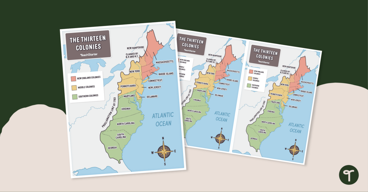
Explore the geography of Colonial America with our printable maps of the 13 Colonies. Designed with accuracy and artistic detail, these maps provide a fascinating look into how the colonies were laid out against each other.
These maps are perfect to use when teaching about Colonial American History, as this set of maps displays the thirteen colonies and their locations in relation to the other colonies.
These maps make excellent additions to interactive notebooks or can serve as instructional posters or anchor charts in the classroom.
These labeled 13 colony maps are available in four easy-to-use formats:
- Full color, full-page labeled map of the 13 colonies
- Full color, half-page map of 13 colonies with labels
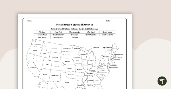
- Black and white, full-page labeled map of the 13 colonies
- Black and white, half-page map of the colonies with labels
A team of dedicated, experienced educators created this resource to support your Geography lessons.
What Were the 13 Colonies?
Need a handy reminder? The original thirteen colonies included
- Virginia
- Maryland
- North Carolina
- South Carolina
- New York
- Delaware
- Georgia
- New Hampshire
- Massachusetts
- Connecticut
- Pennsylvania
- Rhode Island
- New Jersey
Easily Prepare This Resource for Your Students
Use the dropdown icon on the Download button to choose the PDF version of your choice.
Print on cardstock for added durability and longevity.
Don’t stop there! We’ve got more activities and resources to accompany your map of the original 13 colonies.
[resource:4827276] [resource:4836075] [resource:4817391]




0 Comments
Write a review to help other teachers and parents like yourself. If you'd like to request a change to this resource, or report an error, select the corresponding tab above.