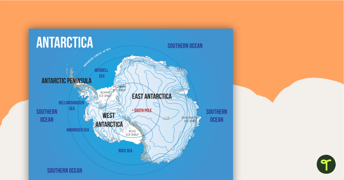
A map showing the layout and major features of Antarctica.
The Southernmost Continent: Antarctica
Out of the seven continents that make up our magical planet, the most unforgiving, inhospitable environment is that of the southernmost continent, Antarctica.
Antarctica is the fifth-largest continent, covering an area of approximately 5.5 million square miles. Due to the fact that it’s the coldest and driest continent on Earth, it also has the smallest population. Few people live permanently in Antarctica, and it is not a country in its own right. Rather, it is governed by an international agreement called the Antarctic Treaty System.
Multiple Applications of This Map of Antarctica
This colorful classroom map shows some of the major landmarks of Antarctica. It is the perfect resource to accompany your Geography lessons on the world’s seven continents. You may wish to use this poster in the following ways:
- Print the poster on tabloid paper and display it in your classroom as a reminder of the geographical features of Antarctica.
- As you teach your students about the continent of Antarctica, provide students with a smaller version of the poster to paste into their notebooks.
- Add this poster to a classroom display about Antarctica. Encourage students to add facts about Antarctica around the poster.
Download, Print, Teach!
This resource downloads as a full-color PDF and can be accessed via the dropdown menu above.



0 Comments
Write a review to help other teachers and parents like yourself. If you'd like to request a change to this resource, or report an error, select the corresponding tab above.