Geography Teaching Resources
- Free Plan

Free U.S. Mountains, Rivers, and Land Features Worksheet
Apply knowledge of the major U.S. land features, mountains, and rivers with a map labeling worksheet.
- Free Plan
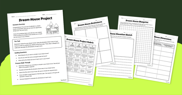
Math Dream House Project
Introduce this math dream house project to your students to help them increase spatial skills while designing the home of their dreams!
- Plus Plan

Looking at Landforms Worksheet
Identify the major landforms of the world with a labeling worksheet.
- Plus Plan
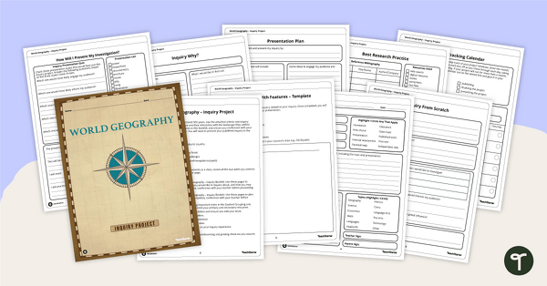
World Geography – Country Research Project Inquiry Task
Help your students discover new countries with our printable country research project template.
- Free Plan

Labeling the Continents and Oceans Worksheets
Turn geography into a fun and educational learning experience by using our free Continents and Oceans worksheets!
- Free Plan
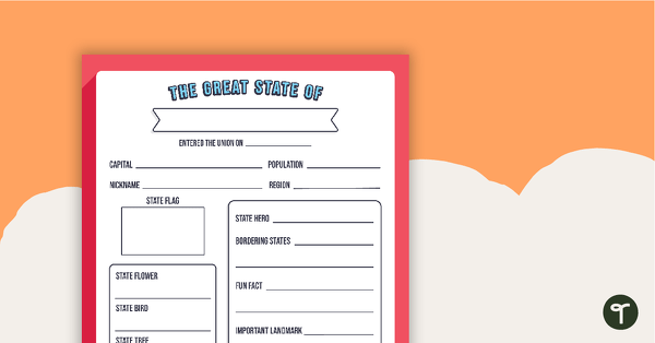
The Great State Of... State Research Template
A free template for students to identify important aspects of their state.
- Plus Plan
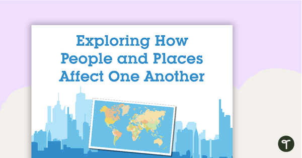
Exploring How People and Places Affect One Another - Word Wall Cards
63 exploring the affects of people and places vocabulary cards.
- Free Plan
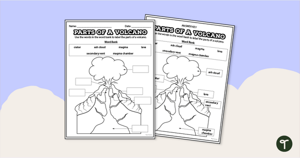
Diagram of a Volcano - Labeling Worksheet
Label the diagram of a volcano with a printable volcano worksheet.
- Plus Plan
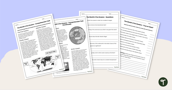
The World's Oceans - Comprehension Worksheet
Explore the world’s five oceans with this detailed comprehension passage and related questions.
- Plus Plan
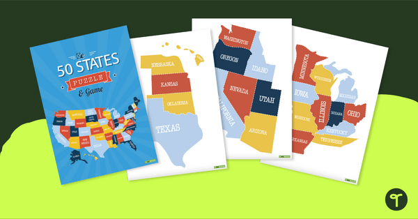
Map of the U.S. Puzzle and Game
A fun puzzle and game to use in the classroom when learning the names and geographical locations of the American States.
- Plus Plan

U.S. Mountains and Rivers - Student Research Workbook
Research and write about the different major mountains, rivers, and land features in the United States with a printable workbook.
- Plus Plan

13 Colonies Map Labeling Worksheet
Locate and identify the 13 original colonies of the United States with a map labeling worksheet.
- Free Plan
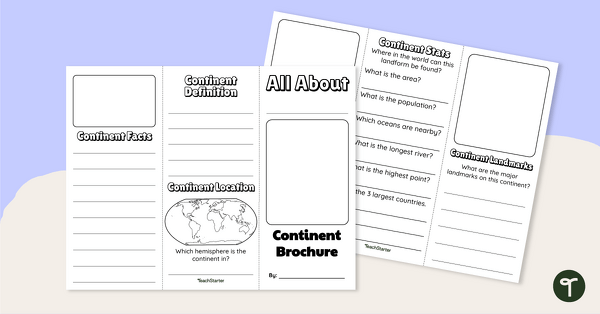
World Continents Brochure Template
Replace your continents worksheets with a printable continents brochure project.
- Free Plan
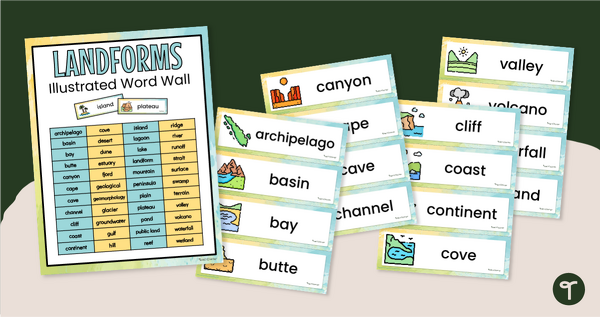
Illustrated Landform Vocabulary Word Wall
Show your students examples of different landforms with a set of printable Landform word and picture cards.
- Free Plan
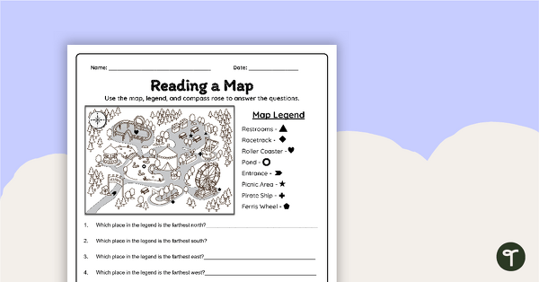
Reading a Map Worksheet
Develop elementary grade map skills with a map-reading worksheet.
- Plus Plan
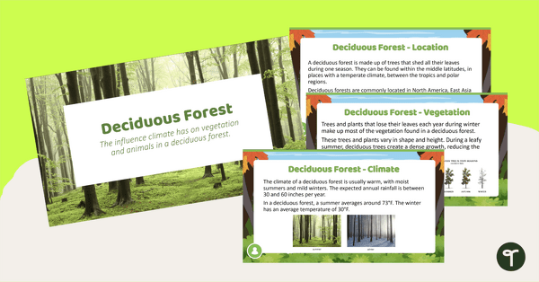
Deciduous Forest Biome Slide Deck
An 11-slide editable PowerPoint to use in the classroom when learning about deciduous forests.
- Plus Plan
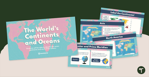
The World's Continents and Oceans Instructional Slide Deck
Explore the seven continents and five oceans of the world with this comprehensive teaching presentation.
- Plus Plan
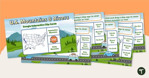
U.S. Mountain and River Interactive Clip Cards
Identify the major rivers and mountains in the United States with a set of Google Slides interactive clip cards.
- Free Plan
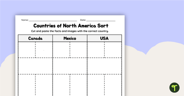
Countries of North America Sort
Practice identifying North American countries' locations, flags, and symbols with a quick and easy sorting worksheet.
- Plus Plan
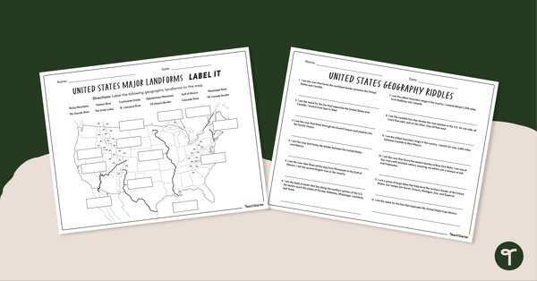
Major U.S. Land Features Worksheets
Discover and identify the major rivers, mountains, and landforms in the United States with an easy-to-use set of worksheets.
- Plus Plan
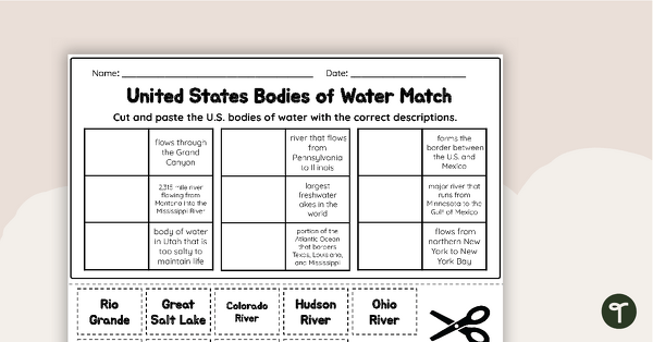
U.S. Geographic Features - Bodies of Water Worksheet
With this worksheet, students will understand reflexive pronouns and how they are used in sentences.
- Plus Plan
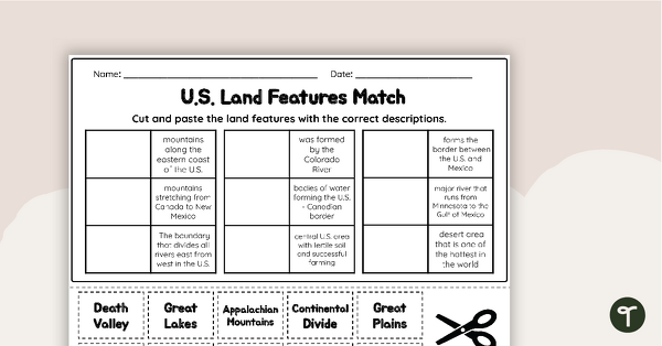
U.S. Land Features Matching Worksheet
Apply knowledge of the major U.S. rivers, mountains, and land features with a matching worksheet.
- Free Plan
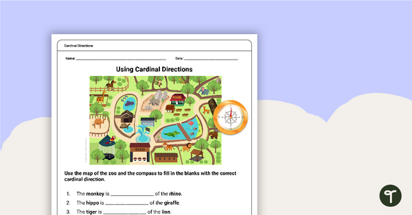
Free Map Skills Worksheet- Using Cardinal Directions
A worksheet to practice using cardinal directions.
- Plus Plan
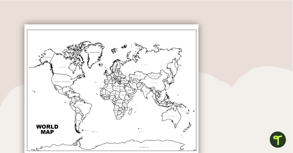
World Map with Countries Labeled
Print a labeled world map for the classroom with the various countries of the world.
- Plus Plan
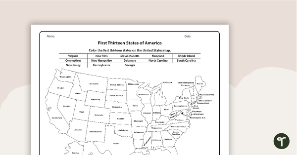
Maps of America - The 13 Colonies Worksheets
A set of maps to display in the classroom when learning about the first thirteen states of America.
- Free Plan
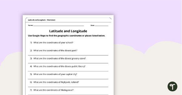
Latitude and Longitude Worksheet
Use this free latitude and longitude worksheet along with Google Maps to teach your students about longitude and latitude.
- Plus Plan
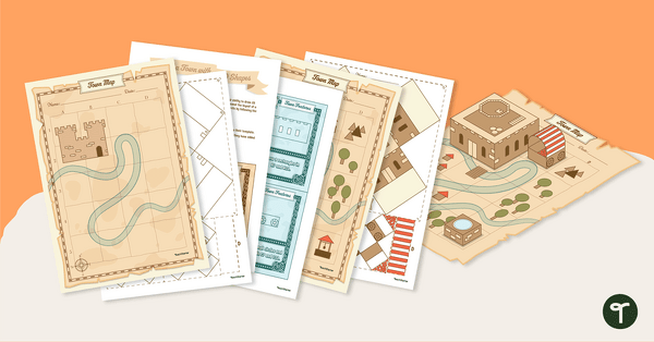
Ye Olde Geometry Town Project
Build a charming medieval town with our Ye Olde Geometry Town project, designed to give your students engaging hands-on practice with multiple geometry and social studies standards.
- Plus Plan
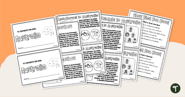
The Continent of Australia - Mini-Book
Explore the wonders and delights of the continent of Australia with this informative printable mini-book.
- Plus Plan
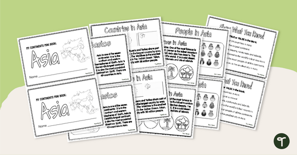
The Continent of Asia - Mini-Book
Explore the wonders and delights of the continent of Asia with this informative printable mini-book.
- Plus Plan
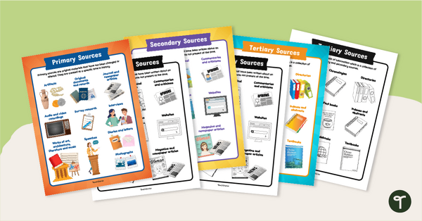
Primary, Secondary & Tertiary Sources Poster Pack
Introduce your students to examples of primary, secondary, and tertiary sources of information with a printable set of anchor charts.
- Plus Plan
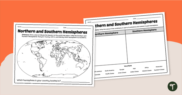
Earth's Hemispheres Worksheets
Practice identifying landforms in the northern and southern hemispheres with a pair of printable geography worksheets.
- Plus Plan
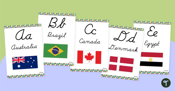
Flags of the World - Classroom Alphabet Line
Display the alphabet in print or cursive with a unique Flags of the World Alphabet Line.