Geography Teaching Resources
- Plus Plan
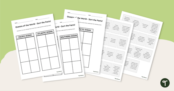
Oceans of the World - Cut and Paste Worksheet
Explore some key facts about the world’s five oceans with this cut-and-paste worksheet.
- Plus Plan
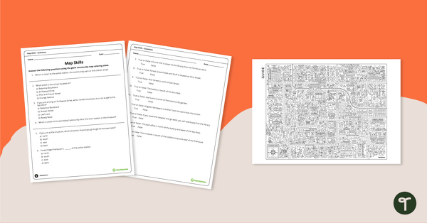
Community Giant Coloring Page and Map Skills Worksheet
An activity to practice map skills using a giant map of a community.
- Plus Plan
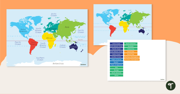
Map of the World - Labeling Activity
Discover and label the world's continents and oceans with this blank map of the world.
- Plus Plan
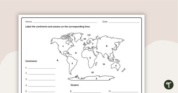
Where in the World? - Worksheet
Practice labeling the continents and oceans on a map with this worksheet.
- Plus Plan
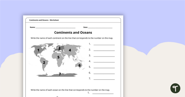
Continents and Oceans Worksheet
A worksheet to practice identifying the 7 continents and 5 oceans.
- Plus Plan
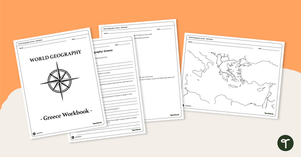
Features of Greece Map & Geography Worksheet Pack
Print a map of Greece and pack of geography worksheets for 6th grade.
- Plus Plan
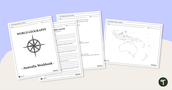
Physical Features of Australia – Geography Worksheets
A printable pack of worksheets for students to learn about Australia's geography and complete a labeled map of Australia.
- Plus Plan
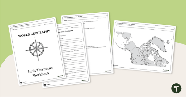
Geography of the Inuit - Canada Territories Worksheets
A workbook for students to use their investigation and map while learning about civilizations in Inuit Territories.
- Plus Plan
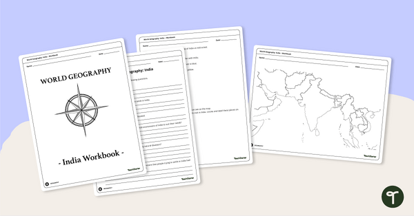
Countries of the World - Geography of India Worksheets
A workbook for students to use their investigation and map skills while learning about civilizations in India.
- Plus Plan
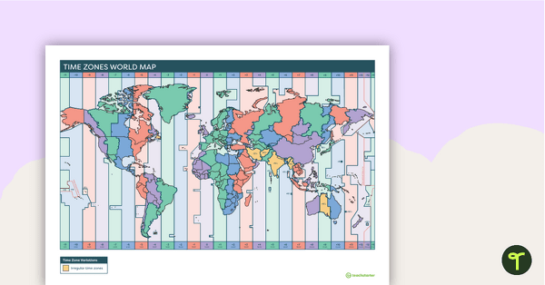
Printable Time Zone World Map
A poster to display in the classroom when locating the different time zones of the world.
- Plus Plan

World Biomes Map
Locate and explore the different biomes of the world with this engaging classroom poster.
- Plus Plan
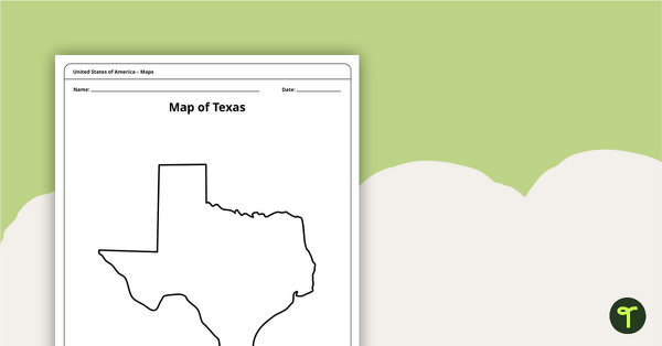
Outline of Texas - Printable Blank Map
A blank map of Texas to use during Geography lessons.
- Plus Plan
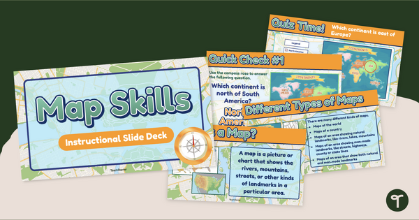
Map Reading for Kids - Primary Map Skills Instructional Slide Deck
Teach of the components of a map with an instructional slide deck for first grade.
- Plus Plan
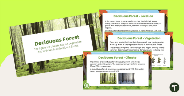
Deciduous Forest Biome Slide Deck
An 11-slide editable PowerPoint to use in the classroom when learning about deciduous forests.
- Plus Plan
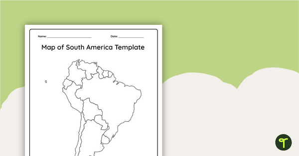
Blank Map of South America
This blank map of South America is perfect for elementary and middle school classes with editable Google Slides and printable PDF versions.
- Plus Plan

Printable Map of Native American Tribes of North America
Print and use a detailed map showing the regions of native American tribes.
- Plus Plan
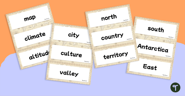
World Geography – Vocabulary Word Wall
Content-specific vocabulary cards for a word wall based on the World Geography resources.
- Plus Plan
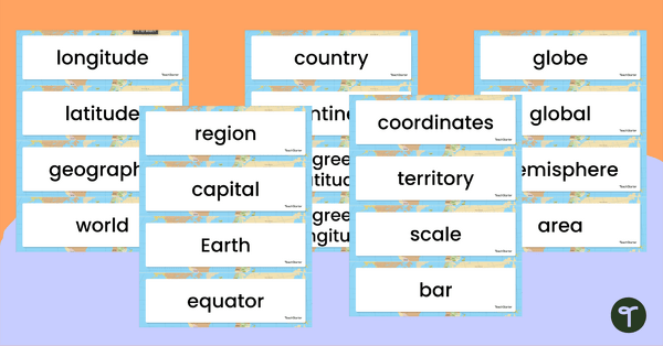
Geography Vocabulary Word Wall Cards
Print a set of 100 geography-related vocabulary word cards for a word wall.
- Plus Plan
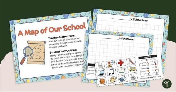
A Map of Our School - Mapmaking Project
Develop primary grade map skills with a map-making project for first and second grade.
- Plus Plan
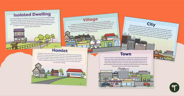
Types of Settlements Posters
5 beautifully illustrated posters explaining the various types of settlements.
- Plus Plan
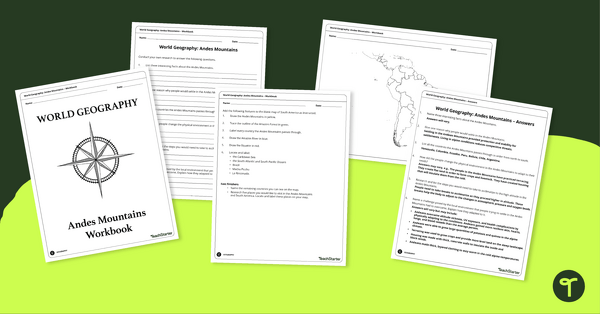
Analyze and Label South America Map & Andes Mountain Worksheet Pack
Explore civilizations in the Andes Mountains with students using the printable map and worksheet pack for sixth graders.
- Plus Plan
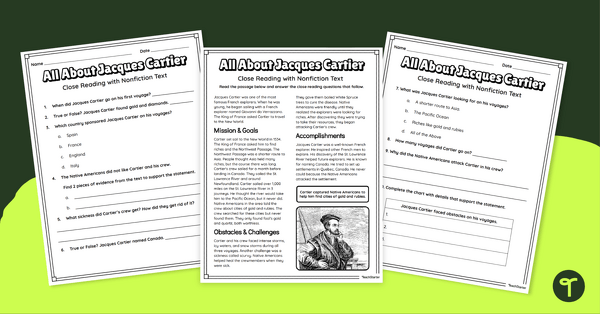
Jacques Cartier Comprehension Worksheets
Travel back in time to the Age of Exploration with a look into the life and accomplishments of Jacques Cartier.
- Plus Plan

U.S. Mountains and Rivers - Student Research Workbook
Research and write about the different major mountains, rivers, and land features in the United States with a printable workbook.
- Plus Plan
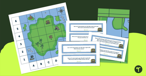
Treasure Map Coding Robot Mat
Implement coding for kids with coding robots and a printable coding robot map activity.
- Plus Plan
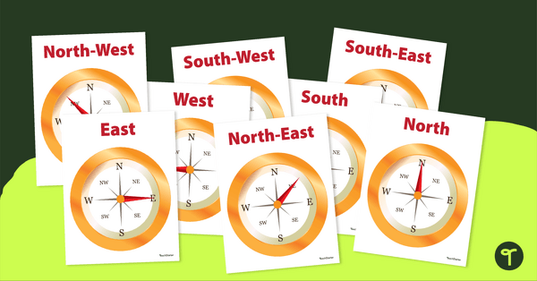
Cardinal and Intermediate Direction Posters - Compass Rose
Display these cardinal and intermediate directions posters when exploring the compass rose with your students.
- Plus Plan
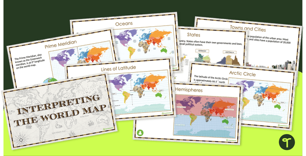
Interpreting the World Map and Map Features – Slide Deck
Explore the key map features of world maps with this 18-slide PowerPoint presentation.
- Plus Plan
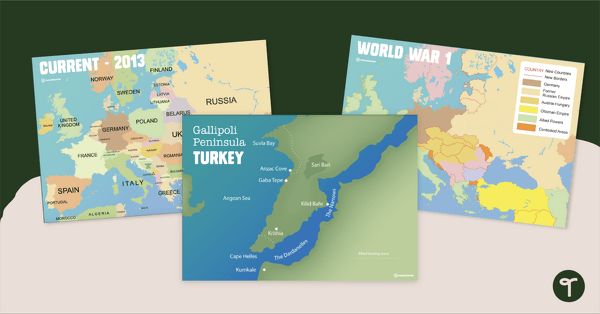
Printable World War 1 Map of Europe
Printable map of Europe and World War 1 to use in the classroom when learning about WW1.
- Plus Plan
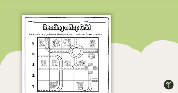
Reading a Map Grid Worksheet
Develop elementary grade map skills with a coordinate grid worksheet.
- Plus Plan
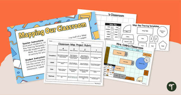
Mapping Our Classroom - Mapmaking Project
Develop primary grade map skills with a classroom mapping project.
- Plus Plan

13 Colonies Map — Labeled
Build understanding of Colonial America with a labeled 13 colonies map for the classroom.
- Plus Plan

13 Colonies Map - Blank
Build understanding of Colonial America with a blank 13 colonies map.
- Plus Plan
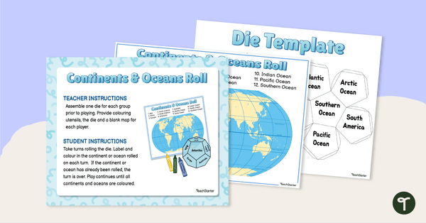
Continents and Oceans Roll and Color Game
Learn to identify the continents and oceans of the world with a Continents and Oceans Roll and Color Game.